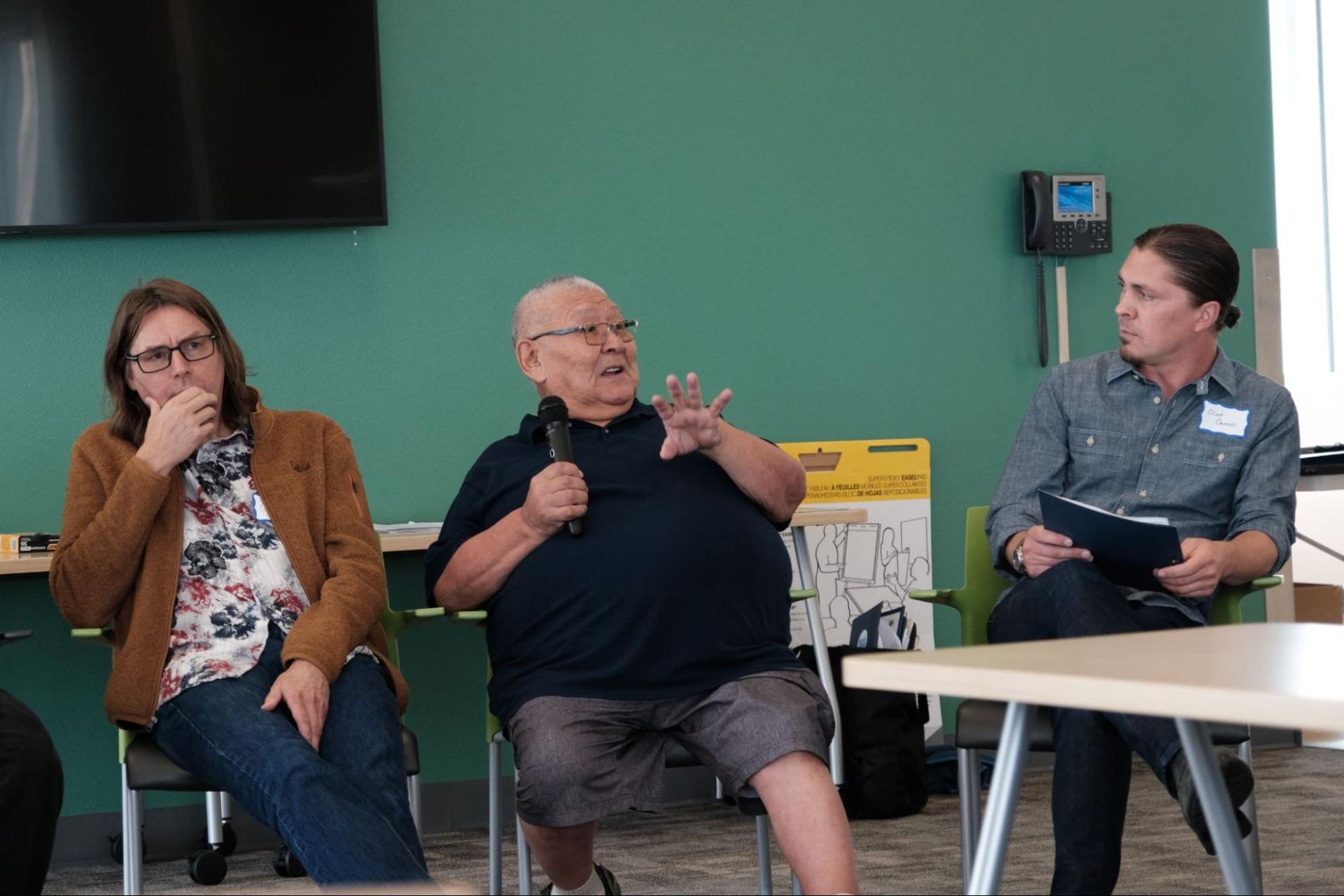
When Mark John, Cultural Advisor of Calista Education and Culture (CEC) and Elder from Toksook Bay, talks about his work with CEC, he stresses the importance of engaging youth and documenting knowledge and place names for future generations. Mark John has been working with colleagues at CEC to document Yup’ik place names for decades. The Yup’ik Elders he works with believe that sharing knowledge freely across generations is an important part of Yup’ik culture. Yup’ik Elders are eager to teach young people the rich history and names of places of their homeland, including camp and settlement sites, rivers, sloughs, rocks, and ponds. Place names hold stories and knowledge important for language and cultural retention.
CEC is a non-profit organization representing over 1,300 Yup’ik tradition bearers of the Yukon-Kuskokwim delta in southwest Alaska. It is the major research organization for the region and is active in documenting the traditional knowledge of the Yup’ik People.
EC has developed a program to address cultural issues, including rapid loss of traditional knowledge. This work is funded by the National Science Foundation and widely supported and encouraged by community members. With ever-increasing technology, one aspect of this plan included creating an online, interactive tool that documents places names and culture stories, known as the Yup’ik Atlas.
The Yup’ik Atlas is an online, interactive map created in collaboration with CEC and the Exchange for Local Observations and Knowledge of the Arctic program (ELOKA). This map is open for public use; however, the primary purpose of the atlas is to share Yup’ik place names and stories in a way that will be useful for teachers, students, and youth in general.
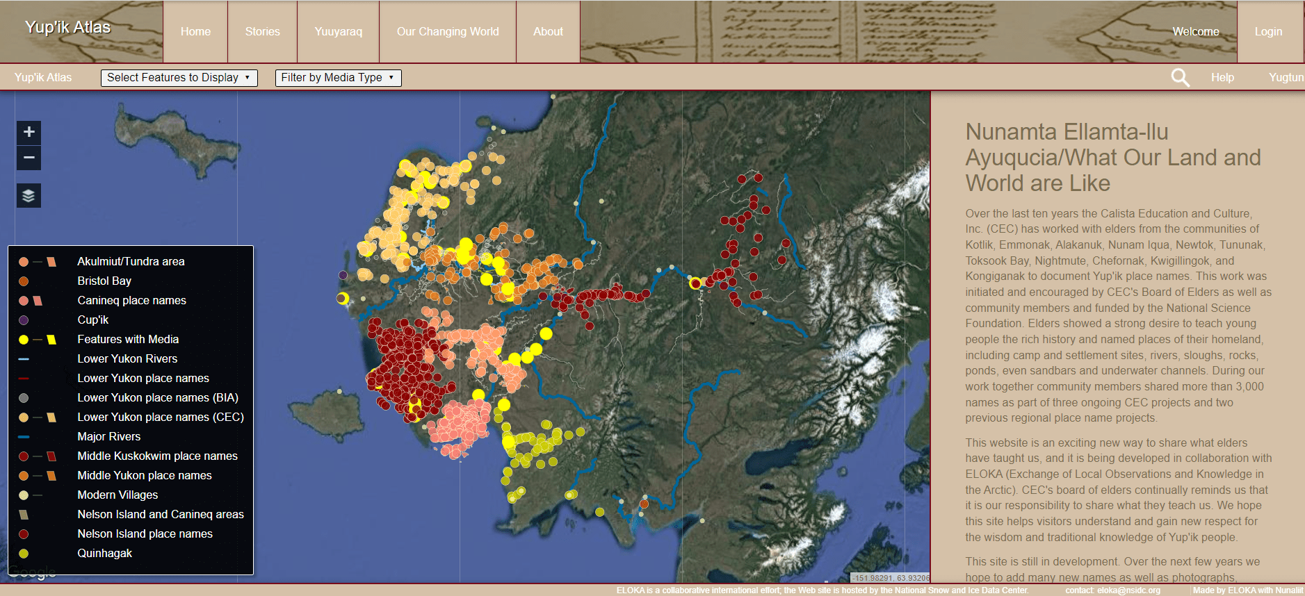
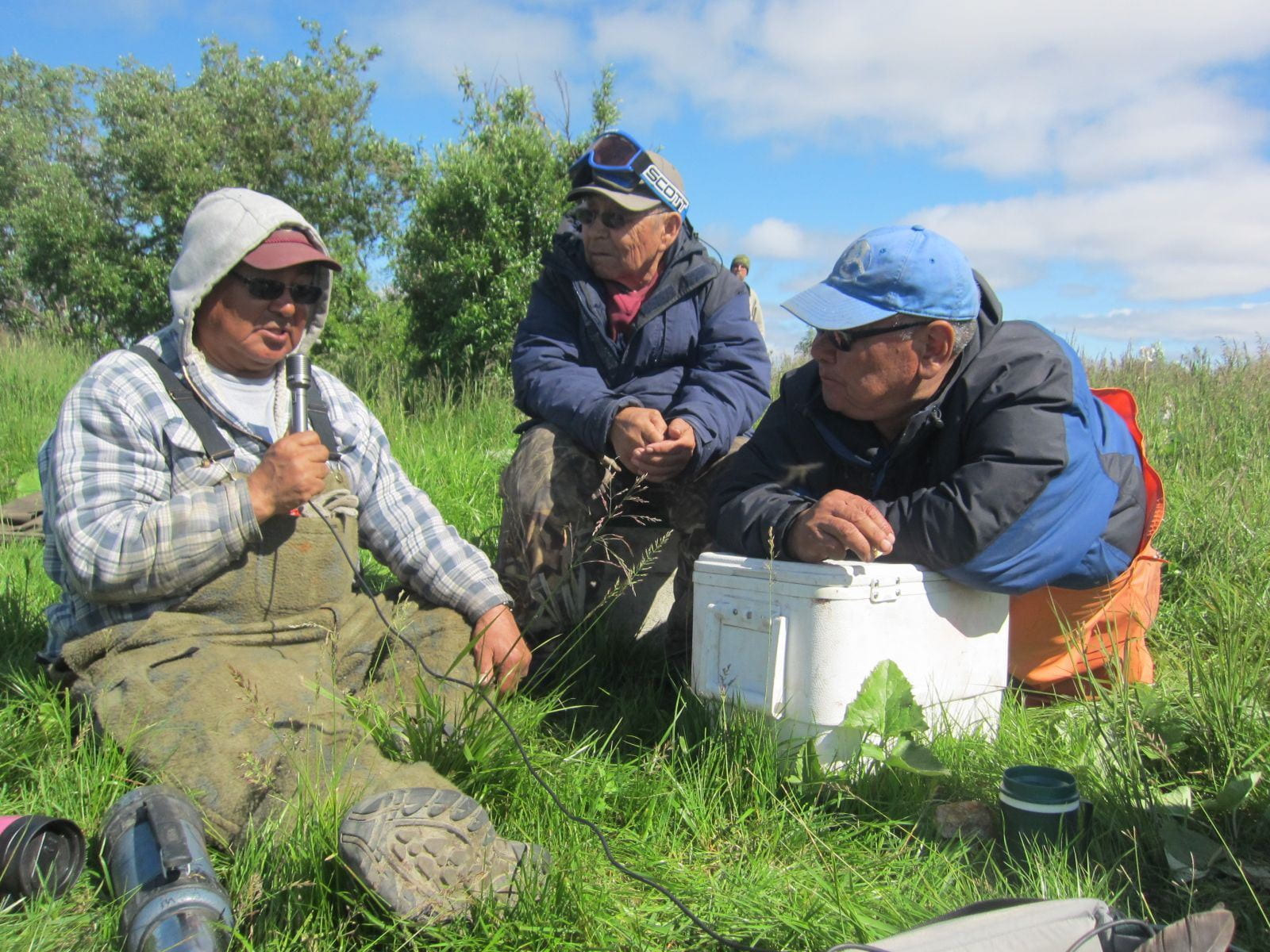
Each point on the Yup’ik Atlas represents a place name; many have an accompanying recording, story, picture, and/or video. Some points have historical and archival photographs and data, while others have pictures taken recently, such as the photo below.
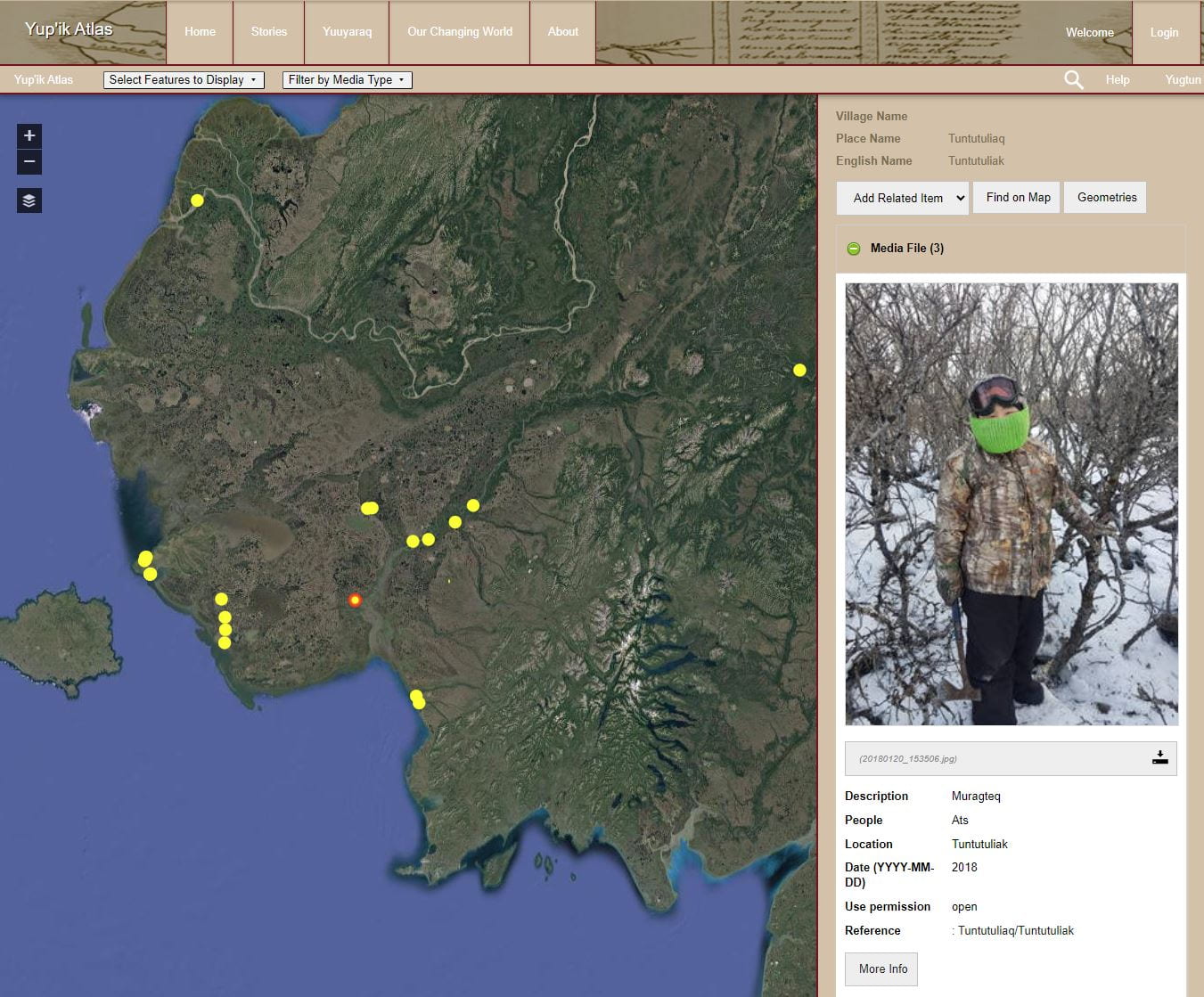
Along with each of the pictures and place names, there is information about when the media or data was collected/added, as well as sharing and privacy settings. While CEC believes in the importance of sharing information, some points hold cultural or personal significance that the knowledge holder only wants students or teachers to access.
The Yup’ik Atlas is included in the Lower Kuskokwim School District’s Yuuyaraq Life Skills curriculum, which consists of classes dedicated to Yup’ik values and language. In this curriculum, students are encouraged to interview Elders about varying topics, and then add these recordings to the atlas. ELOKA provides training for teachers in how to work with students to add place names and related media to the atlas.
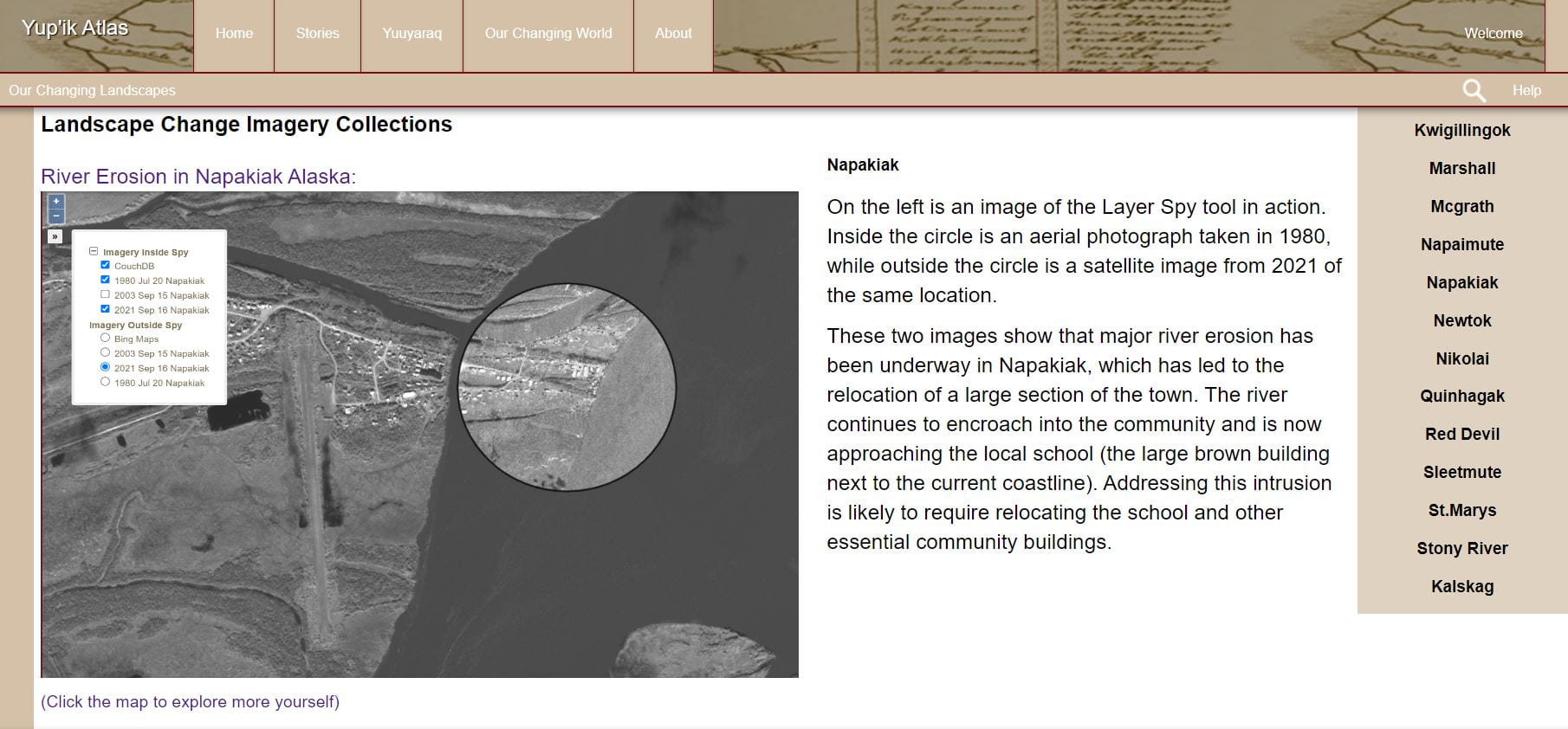
Given the link between Indigenous knowledge and environmental stewardship, a recently added section of the Atlas called “Our Changing World” connects place names and climate change. This module combines climate change science and Yup’ik knowledge, and focuses on how to understand climate change projections locally, such as what warmer summers mean for berry harvests, or how changing climate might impact salmon populations.
ELOKA’s role in the Yup’ik place names documentation efforts has been to develop and maintain the Yup’ik Atlas online, and lead trainings for teachers and students to learn how to use the atlas. In March 2023, the ELOKA team received an invitation to share how to use the climate change module of the Yup’ik Atlas to two high school classes, Chefornak and Quinhagak. As a group, they discussed climate change projections, how to understand them, how this relates to change they are seeing locally, and what their Elders are teaching them. A favorite aspect of the students’ was the “Our Changing Landscapes” section”,which allows students to view how the landscape looked historically, compared to more recent images from satellites.
In September 2023, ELOKA participated in the Lower Kuskokwim School District (LSKD) Annual Fall Conference held in Bethel, Alaska, where 420 teachers from the region attended for three days. During this conference, the ELOKA team prepared four sessions to introduce how to navigate and use the atlas, add place names, and use the climate change module.
During the conference, the teachers expressed enthusiasm and interest in using the Yup’ik Atlas as they work to integrate Yup’ik Culture and Language into their lessons. Like Mark John, the teachers share a passion for Yup’ik youth to learn from their Elders, and to have the opportunity to speakYup’ik in school. The Yup’ik Atlas is one part of the exciting and inspiring work that CEC and LKSD are doing to improve language and culture retention, and it is an honor for ELOKA to be a part of it.